 |
|

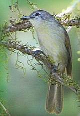
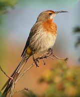
Pink-throated
Twinspot
Photo: Clive Kaplan
|
Want
to be a Birder?
Birding is a
fascinating & rewarding pastime. It is easy an
inexpensive to start. You will only need to acquire
two essential items: A pair of binoculars and a
birding book.
Binoculars:
The best sizes are 8 x 32 or 10 x 40. They are
slender, lightweight and easy to hold. The 1st
figure is the linear magnification and the 2nd
figure the diameter of the front lens in
millimetres. Higher magnifications tends to be shaky
in the field.
Bird
Book:
Several identification books on SA's birds are
available from most of the bookshops.
Consider
joining your local birding club (and if there aren't
any, then start one!)
|
|
Birding
|
BIRDS,
BIRDS, BIRDS
The Hazyview region is home to ± 450 bird
species.
(That's more than half of all the bird species in SA !)
|
 Important
Bird Areas (IBA) Important
Bird Areas (IBA)
Hazyview is situated midway between two IBAs: the Kruger
National Park (IBA SA002) to the east and the Mac Mac
Escarpment & Forests (IBA SA012) to the
west. In addition, three other IBAs are in close
proximity: the Graskop Grasslands (IBA SA011), the Blyde
River Canyon (IBA SA010) and the Misty Mountain Natural
Heritage Site (IBA SA013).
More info on BirdLife South Africa's Birding Routes page.
Other
Birding Areas
Some of the other
(very productive) birding areas near Hazyview include the
Peebles Valley (which include the Jock of the Bushveld
Conservancy and the Petra Mountain Nature Reserve), the Kiepersol/Hazyview Conservancy, and the
Sabie2Kruger Birding Route.
Birds &
Vegetation
Different bird species are closely associated with different
vegetation types. From its source at an altitude of 2,000
meters, to where it enters Mozambique at an altitude of 150
meters above sea level, the Sabie River cuts through 12
vegetation types, over a distance of only 150 km (as the
crow flies). These vegetation types, as well as the riverine
vegetation along the Sabie River, sustain an abundant
diversity of bird habitats.
Vegetation Types along the Sabie River
(From
source to the Mozambique border)
- Long Tom Pass Montane Grassland
- Mpumalanga Afromontane Forest
- Northern Escarpment Dolomite Grassland
- Northern Escarpment Quartzite Sourveld
- Legogote Sour Bushveld
- Subtropical Afromontane Forest
- Pretoriuskop Sour Bushveld
- Granite Lowveld
- Gabbro Grassy Bushveld
- Delagoa Lowveld
- Sweet Arid Basalt Lowveld
- Northern Lebombo Bushveld
(Source: Mpumalanga
Biodiversity Conservation Plan Handbook - MBCP, 2007
by Tony A. Ferrar and Mervyn C. Lötter)
|

Pearl-spotted Owlet
Photo: Warwick Tarboton
|

Need Advice?
For more
information about birding in the
Hazyview/Sabie/KNP area, contact Trips SA Tourist
Information Office on
013 764-3399 or
info@hazyviewinfo.co.za
|
|
Testing Binoculars
Examine the edge of a white building which is in
full sunlight through the instrument. Then move
the image towards the edge of the field of
vision. If coloured fringes appear on the edge
of the wall, the instrument suffers from
chromatic aberration. If the wall appears to
bend or become blurred, spherical aberration is
present. A good instrument should show neither
of these effects.
|
|
|
|
Red
Data Book Categories
Critical
50% chance of going extinct in 5 years
Edangered
20% chance of going extinct in 20 years
Vulnerable
10% chance of going extinct in 100 years
Near-Threatened
Likely to become Vulnerable in the near future
|
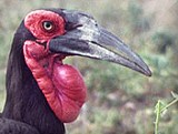
Southern Ground Hornbill
Photo: Biodiversity Explorer
|
Endangered,
Vulnerable & Threatened Birds
(Links
to Biodiversity Explorer's web site)
|
|
Rare Bird Sightings
(#Roberts
Number)
Pennantwinged Nightjar (#410)
Eurasian
Blackcap (#620.1)
Sooty
Tern (#332)
Grey
Wagtail (#715)
Bittern
(#80)
Palmnut
Vulture (#147)
|

Crowned Eagle
|
|
|
|
What is a
Pentad?
The Southern African
Birding Atlas Project2 (SABAP2) is the 2nd project
of the South African National Biodiversity
Institute (SANBI) and BirdLife South Africa with
the main aim of establishing "A
scientifically rigorous, repeatable platform
for tracking through time and space the
impacts of environmental change on southern
African birds, through standardized data
collection on bird distribution and an index
of abundance."
As part of the data
collection process, Southern Africa was divided
into a grid of 5 minutes of latitude by 5
minutes of longitude - each grid block referred
to as a pentad. A pentad (in the Hazyview area)
is a rectangle of about 8.4km (east/west) x
9.2km (north/south) and covers an area of
77.79km2 (7,779ha).
Each of SA's 1:50 000
topo-cadastral maps would, therefore, contain 9
pentads. The Sabie River, from source to
the Mozambique border, is covered by 23 pentads.
|
|
|
SABIE2KRUGER
Birding Route
Experience South African birding at it's very
best on the Sabie2Kruger Birding Route.
Follow the Sabie River from its source in the
mountains high above the town of Sabie,
through Hazyview and into the Kruger National
Park to the Mozambique border - a drop in
elevation of ± 2,000 meters.
|
Birding
Sites along the
SABIE2KRUGER Birding Route
- In order of location from
the source of the Sabie River.
- Distances are by road from
Hazyview town.
- Bird
name Birds Endemic to South Africa are
shown in red.
 Private Sites -
entrance and the use of the facilities, are at the
discretion of the owner/manager. Please ask permission
first before you start wandering off on these
properties. Private Sites -
entrance and the use of the facilities, are at the
discretion of the owner/manager. Please ask permission
first before you start wandering off on these
properties.
 Public Sites - open to the public, but a
nominal entrance fee may be charged. Public Sites - open to the public, but a
nominal entrance fee may be charged.
Sabie2Kruger Birding Route Map

View Larger & More Detailed map
|

Taita Falcon
Photo: Ron Hartley
|
|
|
|

Blue
Crane
Photo: John Kormendy
|
|

Secretarybird
Photo: Phil Penlington
|
|

Blue Swallow (Juvenile)
Percy FitzPatrick Institute of African Ornithology
|
| Misty
Mountain Natural Heritage Site (IBA SA013) |
| Distance |
68km |
| GPS |
25° 10'
32" S | 30° 39' 37" E |
| Altitude |
1,660m |
| Pentad |
2510_3035 |
| Facilities |

 
    |
| Vegetation |
Mpumalanga
Afromontane Forest &
Long Tom Pass Montane Grassland |
| Species |
|
|

Yellow-breasted
Pipid
Photo: Clive Kaplan
|
|

Forest
Canary
Photo: Gareth Hazell
|
| Horse
Shoe Falls |
| Distance |
57km |
| GPS |
25° 07'
50" S | 30° 41' 41" E |
| Altitude |
1,140m |
| Pentad |
2505_3040 |
| Facilities |

|
| Vegetation |
Long Tom
Pass Montane Grassland &
Northern Escarpment Dolomite Grassland |
| Specials |
|
|

Knysna Turaco
Photo: Phil
Penlington
|
|

Yellow-throated Woodland Warbler
Photo: Richard Montinaro
|
| Lone
Creek Falls |
| Distance |
54km |
| GPS |
25° 06'
10" S | 30° 42' 38" E |
| Altitude |
1,130m |
| Pentad |
2505_3040 |
| Facilities |
|
| Vegetation |
Long Tom
Pass Montane Grassland &
Northern Escarpment Dolomite Grassland |
| Specials |
Orange
Ground-Thrush, Knysna Turaco, Yellow-throated
Woodland-Warbler, Yellow-streaked Greenbul, Forest
Canary |
|

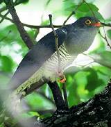
Narina Trogon
|
|

Gorgeous Bush-Shrike
Photo: Ian Sinclair
|
| Bridal
Veil Falls |
| Distance |
51km |
| GPS |
25° 05'
01" S | 30° 43' 41" E |
| Altitude |
1,120m |
| Pentad |
2500_3040 |
| Facilities |
|
| Vegetation |
Mpumalanga Afromontane Forest &
Northern Escarpment Dolomite Grassland &
Northern Escarpment Quartzite Sourveld |
| Specials |
|
|
Yellow-streaked Greenbul
Photo Clive Kaplan
|

Southern
Bald Ibis
Photo: Clive Kaplan
|
| Ligna Lodge |
| Distance |
47km |
| GPS |
25° 06'
01" S | 30° 45' 41" E |
| Altitude |
1,020m |
| Pentad |
2505_3045 |
| Facilities |
|
| Vegetation |
Northern
Escarpment Dolomite Grassland &
Northern Escarpment Quartzite Sourveld |
| Specials |
|
|

Pied Kingfisher
Photo: Ian Sinclair
|
|

White-starred Robin
Photo: Phil Penlington
|
| Castle
Rock - Sabie's Municipal Caravan Park |
| Distance |
46km |
| GPS |
25° 06'
01" S | 30° 45' 41" E |
| Altitude |
1,020m |
| Pentad |
2505_3045 |
| Facilities |
|
| Vegetation |
Northern
Escarpment Quartzite Sourveld & |
| Specials |
|
|

Wailing Cisticola
Photo: Clive Kaplan
|
|
Gurney's
Sugarbird
Photo: Phil Penlington
|
| Floreat
Riverside Lodge |
| Distance |
45km |
| GPS |
25° 06'
01" S | 30° 45' 41" E |
| Altitude |
1,020m |
| Pentad |
2505_3045 |
| Facilities |
|
| Vegetation |
Northern
Escarpment Dolomite Grassland &
Northern Escarment Quartzite Sourveld |
| Specials |
|
|

Orange Ground Thrush
Photo: Kevin Ravno
|
|

Southern Tchagra
Photo: Clive Kaplan
|
| Tannamera
Lodge |
| Distance |
20km |
| GPS |
25° 02'
41" S | 30° 57' 03" E |
| Altitude |
770m |
| Pentad |
2500_3055 |
| Facilities |
|
| Vegetation |
Legogote
Sour Bushveld |
| Specials |
|
|

Olive Bush-Shrike
Photo: Richard Montinaro
|
|

Olive Woodpecker
Photo: Phil Penlington
|
| Böhms
Zeederberg |
| Distance |
18km |
| GPS |
25° 02'
27" S | 30° 57' 58" E |
| Altitude |
800m |
| Pentad |
2500_3055 |
| Facilities |
 |
| Vegetation |
Legogote
Sour Bushveld |
| Specials |
|
|

Striped Pipit
Photo: Phil Penlington
|
|
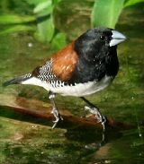
Red-backed Manniken
Photo: Kevin Ravno
|
|

Purple-crested Turaco
Photo: Gareth Hazell
|
|
African Cuckoo
Photo: Clive Kaplan
|
| Cuckoo
Ridge |
| Distance |
16km |
| GPS |
25°
02' 26" S | 31° 00' 17" E |
| Altitude |
685m |
| Pentad |
2500_3055 |
| Facilities |
|
| Vegetation |
Pretoriuskop
Sour Bushveld |
| Specials |
|
|

Great Spotted Cuckoo (Juv.)
Photo: Clive Kaplin
|
|

Chorister
Robin-Chat
Photo: Duncan Roberstson
|
| Rock-a-Bye |
| Distance |
12km |
| GPS |
25° 01'
51" S | 31° 02' 10" E |
| Altitude |
539m |
| Pentad |
2500_3055 |
| Facilities |
|
| Vegetation |
Pretoriuskop
Sour Bushveld |
| Specials |
|
|

Yellow Weaver
Photo: Gareth Hazell
|
|

Half-collared Kingfisher
Photo: Clive Kaplan
|
| Lions
Rock Golf Estate |
| Distance |
8km |
| GPS |
25° 02'
27" S | 30° 57' 58" E |
| Altitude |
520m |
| Pentad |
2500_3055 |
| Facilities |
|
| Vegetation |
Pretoriuskop
Sour Bushveld |
| Specials |
|
|

Southern
Boubou
Photo: Phil Penlington
|
|

Little Bee-eater
Photo: Clive Kaplan
|
| Idle
& Wild |
| Distance |
7km |
| GPS |
25° 02'
12" S | 31° 04' 47" E |
| Altitude |
525m |
| Pentad |
2500_3055 |
| Facilities |
|
| Vegetation |
Pretoriuskop
Sour Bushveld |
| Specials |
|
|

African Pygmy Goose
Photo: Clive Kaplan
|
|

Red-capped Robin-Chat
Photo: Kevin Ravno
|
| Laughing
Waters |
| Distance |
7km |
| GPS |
25° 02'
27" S | 30° 57' 58" E |
| Altitude |
508m |
| Pentad |
2500_3055 |
| Facilities |
|
| Vegetation |
Pretoriuskop
Sour Bushveld |
| Specials |
|
|

White-breasted Cuckooshrike
Photo: Kevin Ravno
|
|

Crowned Eagle
Photo: Clive Kaplan
|
| Gecko
Lodge |
| Distance |
3km |
| GPS |
25°
02' 36" S | 31° 06' 16" E |
| Altitude |
557m |
| Pentad |
2500_3055 |
| Facilities |
|
| Vegetation |
Pretoriuskop
Sour Bushveld |
| Specials |
|
|

Verreaux's Eagle
Photo: Clive Kaplan
|
|

African Finfoot
Photo: Ian Sinclair
|
| Casa
do Sol |
| Distance |
9km |
| GPS |
25° 02'
53" S | 31° 04' 52" E |
| Altitude |
570m |
| Pentad |
2500_3055 |
| Facilities |
|
| Vegetation |
Pretoriuskop
Sour Bushveld |
| Specials |
|
|

African Pigmy Kingfisher
Photo: Clive Kaplan
|
|

Swee Waxbill
Photo: Kevin Ravno
|
| Sabi
River Sun |
| Distance |
2km |
| GPS |
25° 02'
05" S | 31° 06' 50" E |
| Altitude |
480m |
| Pentad |
2500_3055 |
| Facilities |
|
| Vegetation |
Pretoriuskop
Sour Bushveld |
| Specials |
|
|

Spectacled Weaver
Photo: Phil Penlington
|
|
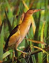
Little Bittern
Photo: Simon Milliken
|
|

Violet-backed Starling
Photo: Phil Penlington
|
|

Green-backed Heron
Photo: Kevin Ravno
|
| Kruger
Park Lodge |
| Distance |
1km |
| GPS |
25° 01'
46" S | 31° 08' 04" E |
| Altitude |
465m |
| Pentad |
2455_3130 |
| Facilities |
|
| Vegetation |
Granite
Lowveld |
| Specials |
|
|
Grey-headed Kingfisher
Photo: Clive Kaplan
|
|

Pel's Fishing Owl
Photo: Clive Kaplan
|
|
Purple Roller
Photo: Clive Kaplan
|
|

Lappet-faced Vulture
Photo: Clive Kaplan
|
| Albasini
Ruins (in KNP) |
| Distance |
15km |
| GPS |
25° 01'
14" S | 31° 14' 25" E |
| Altitude |
415m |
| Pentad |
2500_3115 |
| Facilities |
|
| Vegetation |
Pretoriuskop
Sour Bushveld |
| Specials |
|
|

Coqui Frankolin
Photo: Phil Penlington
|
|

Rufous-bellied Heron
Photo: Clive Kaplan
|
| Lake
Panic Bird Hide (in KNP) |
| Distance |
50km |
| GPS |
24° 58'
51" S | 31° 33' 55" E |
| Altitude |
295m |
| Pentad |
2455_3130 |
| Facilities |

|
| Vegetation |
Granite
Lowveld |
| Specials |
|
|

Allen's Gallinule
Photo Kevin Ravno
|
|

Southern Carmine Bee-eater
Photo: Clive Kaplan
|
| Skukuza
Rest Camp (in KNP) |
| Distance |
52km |
| GPS |
24° 59'
41" S | 31° 35' 25" E |
| Altitude |
280m |
| Pentad |
2455_3135 |
| Facilities |
|
| Vegetation |
Granite
Lowveld |
| Specials |
|
|

Southern Ground-Hornbill
Photo: Kevin Ravno
|
|

Greater Honeyguide
Photo:Phil Penlington
|
| Nkuhlu
Picnic Terrain (in KNP) |
| Distance |
76km |
| GPS |
24° 59'
56" S | 31° 46' 00" E |
| Altitude |
215m |
| Pentad |
2455_3145 |
| Facilities |
|
| Vegetation |
Granite
Lowveld |
| Specials |
|
|

Bateleur
Photo: Clive Kaplan
|
|

Brown-headed Parrot
Photo: Phil Penlington
|
| Lower
Sabie Rest Camp (in KNP) |
| Distance |
100km |
| GPS |
25° 07'
15" S | 31° 55' 02" E |
| Altitude |
175m |
| Pentad |
2505_3155 |
| Facilities |
|
| Vegetation |
Granite
Lowveld |
| Specials |
|
|

Green Malkoha
Photo: Kevin Ravno
|
|
Baillon's Crake
Photo: Clive Kaplan
|
| Ntandanyathi
Bird Hide (in KNP) |
| Distance |
113km |
| GPS |
25° 12'
35" S | 31° 57' 20" E |
| Altitude |
190m |
| Pentad |
2510_3155 |
| Facilities |
|
| Vegetation |
Northern
Lebombo Bushveld |
| Specials |
|
|

African Fish Eagle
Photo: Clive Kaplan
|
|
|
home
| about | contact
| biodiversity | accommodation | health spas
| cuisine
| to do |
adventure |
golfing | birding | shopping | sitemap
www.hazyviewinfo.co.za
copyright Trips SA, 2018-2020
|